Thứ Năm, 18 tháng 7, 2013

Road Trip to Sequim, Washington & Dungeness Spit

Dungeness Spit Lighthouse with Mount Baker (Cascades) Backdrop

Hi all, Dianne again.  

We packed up bright and early, picked up Robyn and Amanda from their hotel, and all of us together hit the road in the motor home for the Olympic Peninsula of Washington.  If you have visions of us playing the license plate game, auto bingo or singing our way up I-5 through the state of Washington, here is the reality of the trip:
 Amanda and Kaia slept in our bed, and Robyn and Bandido flaked out on the couch.  It was a very quiet ride!   

The most exciting thing were the ubiquitous logging trucks that passed us by.  For a time a semi full of fresh mulch was right in front of us and we enjoyed that fragrance as we drove for a bit.

We set up camp at Rainbow's End RV Park in Sequim, Washington.  First order of business was to have Kaia help us put our Washington state sticker onto our U.S. map.


Back in the early days, when our motor home was new and we had not yet begun fulltiming, Kaia helped us put on the Florida sticker when we took her for a road trip with us.  Looks like we've added quite a few states since then!

Our daughter Robyn is a busy gal, and this was our last day together before she needed to catch a plane back to L.A.  
Scallops


For our last meal together we chose an early dinner at the Sequim Seafood Restaurant, which I would highly recommend if you find yourself in this area.  

Robyn chose scallops and I had crab cakes.  
They were delicious!


Outside the restaurant, Kaia posed with her mom for my camera.


After dinner we decided to take a short hike out to the nearby Dungeness Spit.  
It was sunny and warm when we left Sequim, but several of us were totally under-dressed (no sweatshirts, sandals instead of hiking shoes); definitely the wrong attire for the cold, windy hike down the sandy spit.  

The wind was blowing so hard that we felt we were being sandblasted as we started the walk down the shore.  I immediately put my camera away and used my iPhone for the rest of the time while we were there, not wanting a repeat of our camera failures from the Oregon coast.

There was an interesting display of artifacts washed ashore from the 2011 Japanese Earthquake and resulting Tsunami.  


 It's hard to imagine how these items floated all the way across the Pacific Ocean from Japan.  We didn't see any debris during our walks, but there are Tsunami debris posters all up and down the coasts of Oregon and Washington with instructions on what to do if you find Tsunami debris.

We went back to the motor home and enjoyed watching the classic Lucy & Desi "The Long, Long Trailer" DVD, complete with homemade popcorn and lots of laughs.   

Alarms were set early for the next morning, for we had to make the 2 1/2-hour drive to the Seattle Airport in time for Robyn to catch her flight home to Los Angeles.  Our time with her was way too short!  

The pet photo of the day shows Bandido in his favorite spot, snuggling with Kaia as she slept.

Thứ Ba, 16 tháng 7, 2013

Portland, Oregon Family Time!


Hi all, Dianne here.  We had a busy time with family last week, so our blogs are a bit behind.  We’ll try to remedy that now; Roger and I are both plugging away on blogs so that we can get caught up. This first blog entry is mine, so here goes….

A week ago Sunday we left Fort Stevens State Park and made a mad dash to Columbia River RV Park in Portland, which is very near the Portland International Airport.  As we drove the RV toward Portland, two airplanes were also making their way there, one from Florida and the other from Los Angeles.  We all arrived within an hour of each other!  The girls met up and checked in to a hotel near the airport (we always get Robyn a hotel room because she’s allergic to dogs and cats). Amanda, our other daughter, stayed with her sister in the hotel and our granddaughter, Kaia, stayed with “Meemaw & PopPop” in the motor home.
Bandido and Tequila were very happy to get reacquainted with Kaia!


We were all hungry, so first thing was a meal at The Deck restaurant on a floating dock in a marina on the Columbia River. 
Sisters!


Amanda met up with a friend from college and got a taste of some Portland night life, while the rest of us called it an early night.  We had a long list of things we wanted to see and do the next day, our only full day in Portland.


First on the list was to eat breakfast at Pine State Biscuits, a “must do” recommended by Robyn’s boyfriend Atul.  I promise not to show photos of every meal we ate together, but wow, get a load of breakfast:


Fried chicken, gravy, bacon, and egg on a biscuit (Kaia’s breakfast choice) and check out my biscuits and gravy with egg-over-easy on top:


Definitely an experience not to be missed!!  Thank you, Atul!
Mount Hood was out!


After breakfast we made our way downtown and signed up for a walking tour of Portland.  

While we waited for our 2:00 tour time, we made a stop in the famous Powell Book Store to browse around. 
The bookstore is so large, encompassing an entire city block with multiple floors, that large signs direct you to color-coded rooms of books in different categories.   Powell's shelves used and new books together, so that you can easily find a book, then choose which you'd rather buy, new or used.  I ended up with a stack of paperbacks (used, of course). 


At 2:00 we met up with our tour group outside the Hilton Hotel.  Our tour guide, Dianne, was excellent and gave us a good flavor of the city.  There are bicycle lanes everywhere,
car chargers, even solar-powered waste bins along the street that automatically compact the trash.  Rush hour began while we were just ending the tour, and the streets filled with bicycles and folks obviously on their way home from work, work clothes in backpacks and exercise clothes donned for the ride home.


This building shows trompe-l’oeil art.  It is actually a flat building except for the recessed area in the center.


In one of the downtown parks we found the largest grove of Dutch Elm trees in the United States.  Our guide explained that the Dutch Elm disease that obliterated the elm trees in the eastern half of the country didn’t make it all the way to Oregon. 


This building was designed by Michael Graves, who also designed kitchen wares for Target.  


 In front of the building is the second-largest hammered copper statue in the U.S. (largest is the Statue of Liberty).  Here is Portlandia, kneeling down to welcome visitors to the city:


Both of our daughters were intrigued by this large artwork that invited you to “have a seat”.  They of course proceeded to ham it up with the statue.


In this photo, our guide, Dianne, was explaining how this statue from the 1980s is a good way to tell a tourist: 


First of all, no one in Portland uses an umbrella, and you’d be hard-pressed to find anyone in a three-piece suit.  If the statue were wearing a hoodie and jeans, he’d look more like the locals.


These iconic Benson Bubblers were installed around the city in 1912 by a tee-totaling lumber baron, and are still in use today.


After the tour ended, we stopped at a Thai restaurant for an early supper, then...


We had one last very important stop to make before we left downtown Portland – a trip to the famous Voodoo Donuts!


Now, this is my kind of place! 
Kaia liked it, too. 
 It certainly had a quirky kind of ambiance!

We left with donuts for dessert, plus a box of donuts to enjoy while driving to Washington the next morning.  Check back soon for that blog entry.


The pet picture of the day shows Bandido and Kaia enjoying a game of tug. 

Thứ Tư, 10 tháng 7, 2013

Mount St. Helens, Washington


Roger and Dianne here (joint effort this time)....  

The opening photos show the valley below the Mount St. Helens volcano and the top of the volcano.  Unfortunately, the cloud cover hid the lava dome and the crater.  It was well worth the drive over from Fort Stevens to witness the rebirth of this area and the areas still devastated after the volcano's eruption 33 years ago.

We boarded the dogs at the Bay Breeze facility in Warrenton, OR where they spent the day and received a bath and (needed) nail clipping to get ready for the upcoming visit from  Robyn, Amanda, and Kaia.  So good to know that they will smell sweet (not like dogs) for our kids.  The drive to the national park took about one and a half hours.  After arriving at the park, there was an additional 46-mile drive to the visitor center that was seven miles from the summit.


There were four visitor centers along the way. 
The first was just off the interstate highway and was sponsored by the State of Washington instead of the National Park Service.  It had some interesting displays and we were glad we stopped in there, but be forewarned if you visit there your national park passes will not be honored.  The admission fee is $5 per adult.  How quickly we get spoiled by our senior national park passes!

When we arrived at the Toutle River area, the explosive destruction of the 1980 blast was apparent.  Look at these views of the Toutle 
River that show it has not yet completely recovered from the event.  It was totally scoured and changed by the avalanche of mature trees and rocks that rushed down from the sudden snow melt caused by the volcano eruption. 


As we drove up the side of the mountain and the numerous (and informative) information centers, we encountered a little bit of fog.


This my first view of the volcano.  Look at the detail!


When we entered the Johnson Observatory area, the view improved, somewhat....  We could see the top of the volcano....


and the bottom, but not the middle where the new lava dome is forming ...

We watched the clouds drift by for a while and then went inside to watch an amazing movie of the 1980 eruption of Mt. St. Helens.  The movie itself was worth the 46-mile drive.  At its conclusion, the massive screen lifted to show a partially-cloud-covered view of the volcano through a huge window directly behind.  The visual effect of the final scene of the movie, then the lifting of the curtain to see the same view in real time, gave me chills.  


After the movie, we spent some time at the exhibits while we waited for the clouds to clear (which they did not).  We learned that during the 1980 event, hikers at nearby Mt. Adams and others within the 60-mile "silent zone" did not hear the blast -- while those hundreds of miles away could hear it -- because the sound waves were vertical and not lateral. 

The total destruction of the forests by the pyro flows and heat were mind-boggling.  

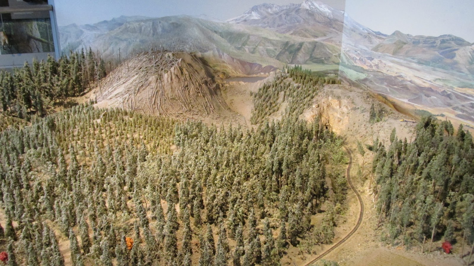
I always wondered what happened to all those trees.  Turns out that Weyerhauser, who owns large tracts of land around the volcano, harvested the logs on their property.  They then pondered whether to let nature take its course or to help it get a jump start by replanting thousands and thousands of trees.  The national park service took a different tack on their land, allowing the area to rejuvenate on mother nature's schedule.   Look at this poster showing recovering forests on Weyerhauser's land, and the areas on the NPS land beyond that are still barren.  There are still differing opinions on which position is better; only time will tell.


These recovering "Indian Paint Brushes" make a bright spot in the National Park Service area of recovery:

In the distance, Spirit Lake is recovering after its massive disruption.  The shape and depth of Spirit Lake is totally different than it was before the eruption.  Somewhere, buried in its depths, is Spirit Lake Lodge and its owner, Harry R. Truman, who refused to leave it during the evacuations before the event.


While we were still at the Johnson Observatory, we were very fortunate to see an excellent presentation from one of the park rangers.  I wish I had caught his name --- it was an outstanding presentation. 


We learned that the areas with only stumps remaining (like where we were standing) took the full explosive force of the blast and landslide.  Nearby, the areas with huge trees downed like matchsticks were all blown down by the pyroclastic flow -- all of the "matchsticks" pointing in whatever direction the hot, hurricane-force winds of gas and rocks from the blast took at that moment, as it swirled around the topography.  Other areas have large stands of dead trees still standing.  The ranger explained that these areas were damaged by just the heat of the event.  


One last look at the hummocks (remnants of huge rocks that were hurled from the volcano), before we head back to pick up our dogs in Warrenton/Astoria just before the doggie day care closing time.


Unfortunately, when it was time to go, the complete view of the volcano was still blocked by the fog.  After driving through very dense fog to get there, we felt fortunate to be able to see any of the mountain at all.  It was totally worth the trip.


SO EXCITING!!!!  On  the way down the mountain, we encountered a rare viewing of Sasquatch!


Here is a shot of Dianne (reluctantly) thanking Bigfoot for allowing us to visit his domain.  (You would not believe the persuading that was involved in taking this picture).  

Actually, you would, if you look at the attitude in 
Dianne's posture.  (She was supposed to be flirting with Bigfoot, like 
Faye 
Wray did with Godzilla.  Oh, well.)  (Dianne:  After looking at my picture, he's lucky I let him use it at all.)


We passed through the interesting town of Astoria for one last time on our way back to the motor home.  This home was about a block away from the "Goonie" house.


One more cool Astoria house before we head to Portland to pick up our girls at the airport. 


The pet picture of the day shows Bandido on our last day at Nehalem Beach with his "precious" stick.
I love my stick!   It smells like fish!