Thứ Hai, 7 tháng 5, 2012

Petroglyph Trail - Mesa Verde, CO

Roger posing like the figure above his left ear
Hi all, Dianne here.  Our third day at Mesa Verde was spent hiking the Petroglyph Trail, a 3-mile, round-trip loop trail that leads to a wall of petroglyphs.   I have to say, this was both the best and most challenging trail I've ever hiked!  Lots of water and sturdy hiking boots are a must.  It's high altitude (7,000 feet), very dry air, and lots of rock scrambling.  The weather was perfect, though; low 70s with bright sunshine.


We logged in at the ranger's station before departing for the hike, which was described as taking two to three hours for the 3-mile loop.  When we finally logged back in after completing our trek, it had taken us every bit of 3 hours, although we went slowly (for us), took our time and stopped at the many markers for Roger to read the descriptions from the trail guide.  


Ancient soot still visible above ruins
On the way to the trail head, we took the short hike down to view the Spruce House ruins. They were much like the ruins we saw on the Cliff Palace tour, so I'll just show a couple of photos with captions of the more interesting things I noticed:


Roger climbing down into a kiva
Roger, the intrepid one, took a ladder down into a below-ground kiva.  
Dianne illustrating height of tower
Initials of John Wetherill, 1800s explorer of the area
Manos and metates used for grinding corn


  After leaving the ruins, we made our way to the                trail head to begin our adventure down 
     the Petroglyph Trail. 


   This early squeeze-through was just a taste of 
    things to come.                        


   Check out the stone steps.       
   There were lots of
  similar stretches of stone         
   stairways, both up and down
  along the trail.  This one was          
  relatively easy, for there 
   were sides to hold onto.


   Striking colors...
    Here are a few more shots from the 
    hike that caught my eye, some with captions:


First rocks to scramble up; my knees took a beating on this trail because I was wearing shorts.


    We passed a perfect place to hide:


Yes, the sky was this blue!

  One point along the trail was particularly interesting.  I'll quote from the trail guide:


"Notice the axe grooves at about eye level on this flat rock.  The Anasazi used stone for tools since they had no metals.  They made axe heads out of hard rocks, sharpening them by rubbing the stones on sandstone.  These axe grooves are the result of such processes."

At one point Roger said, "You go first; I want to take your picture up on the ledge."  So, obedient wife that I am (ha!), I scrambled up on the ledge, only to discover that it led to a dead-end at a steep drop-off.

Now what??  Turns out, we missed a turn and so I scooted back off the ledge and we forged on to find...

More stone steps...


This set of steps was scary (for me, at least), with nothing to grab for balance:


After a quick stop for a sandwich...

We finally reached the petroglyphs:

Here's another segment:

Earlier on the trail, we passed a couple heading back the way they came.  The wife warned us that there were some big rocks to scramble right after the petroglyphs.   She wasn't kidding!   This was the scariest part of the trail for me.  The foot holds were far higher than my legs could manage.  With moral support and Roger literally watching my back(side), I finally found a hand hold and hoisted myself up.  Once we passed that hurdle, we came upon yet more rocks to scramble up: 

We finally made it to the top of the mesa, where the remainder of the trail took us on top of the mesa through pinyon-juniper "pygmy" forest, with occasional spectacular views.  But first, a look back down where we scrambled up:


More interesting sights along the way...

Look closer...

More ledges:


More lovely views:


All that was left to do was cross the rock-topped mesa and make our way back to the museum (flag in distance) to check in at the ranger station.

This is a hike I will never forget!  Although every muscle in my body was sore that evening, we enjoyed it so much that we decided to extend our stay at Mesa Verde and take a second hike on Monday, the Spruce Canyon hike, which one of the rangers suggested was his personal favorite.  

I took so many photos that I made another photobucket album.  Here's a link if you'd like to watch a slide show and experience the entire hike as we did (without the exertion).  It takes a few minutes, but Roger says it's worth it!

Petroglyph Trail Hike slideshow -- All Photos 

The pet photo of the day is my cuddle bug, Tequila, sharing the recliner with me as I added the photos from this hike onto our computer:


Thứ Bảy, 5 tháng 5, 2012

Move Over Indiana Jones - Mesa Verde


Roger here.....  OK, there were no nazis.  I did not find the Ark of the Covenant.  I did not see any booby traps.  No one's face melted off (thankfully, I applied sunscreen).  HOWEVER,  there were amazingly preserved ancient structures.  There were tunnels to crawl through.  There were temples where religious rites were performed by the ancestors of the Pueblo people.  There were narrow crevasses to squeeze through.  There were narrow ledges to tiptoe around.  There were hand-carved steps in the rocks.  AND, there were lots of tall ladders that towered straight up over at the edge of the abyss.  (Incidentally, there was also fascinating information about an ancient culture, important for a retired educator.)  This was a perfect day for me.


Dianne opted not to join me on this adventure due to her fear of ladders.  A good choice on her part.


Before reading on, let's get in the right frame of mind.  Imagine the music from the Indiana Jones movies....  da da da daaaa,   da da daaaa,   da da da daa   da da da da DAAAA!


Ok,  we are on our way to the ranger-led tour of the Balcony House at Mesa Verde National Park. After meeting park ranger, Bill, at the appointed rendevous, our intrepid group (including people much older than me and very young children) followed our leader down, down, down into the canyon.  After going down, we went up.  Up, up, up, the 32 foot ladder to the next level.  Look at the view behind us as we reached the top.  Quite a drop!


A couple more hurdles before entering the ancient village.  The narrow squeeze through the crevasse between two gigantic rocks.


Then, another ladder climb into the floor of the village.


And then the first view of the mystical place.


The small village that you see above was built by a culture that was once known as the Anasazi.  We now know that those people were the ancestors of the Pueblo people.  For unknown reasons, they abandoned their cliff dwellings in the 1500's and moved back to the top of the mesas from where they had come --- most of them to the larger cultural centers.  


If you look closely at the previous large photo, just to the right of the ladder, you can see these carved footstep that led to the dark area at the back of the buildings.


The cave behind the buildings hides a spring.  This is not a great picture of the spring, but it is amazing that the ancient Pueblo people were able to create a water system on the land above the canyon that diverted spring runoff so that it would seep into the sedimentary rock and ultimately bubble into the Balcony House spring.  Amazing.


After walking through the cave, another part of the village emerged.  The ceremonial kiva with its fascinating cold-air duct to permit air flow.  


Just above the kiva, Ranger Bill explains how corn was the main source of food for our ancient friends --- 70 percent of their diet.


OK, enough of this educational stuff.... time to escape.  Start the Indiana Jones music.


One last look over the edge of the balcony.


Our first obstacle was to squeeze through another narrow slit in the rocks.  But wait, the ancient ones built a wall over the upper portions of the exit, forcing us to crawl for 12 feet on our hands and knees.


Oh no.... another series of ladders.


Our final obstacle... ancient hand-hewn footholds carved into the rock --- an Anasazi ladder.  Thank you Ranger Bill for the chains.


Adventure completed, more Mesa Verde exploring to come.  Time for Dianne to add the pet photo of the day.  


Dianne here -- After the wild video of Bandido and Tequila playing hard a couple of posts back, I thought I'd show you how they look most of the time:


Cuddly Little Angel


Sleepy-Head
For those of you who know them and have seen them in action, I know it's hard to believe!!

Thứ Sáu, 4 tháng 5, 2012

Mesa Verde, Colorado

Hi all, Dianne here.  We're spending four days at Mesa Verde, Colorado, mainly to visit the Ancient Pueblo ruins in the national park.  


View from our front windshield
We can see Mesa Verde out our front window at the rv park, and also can see the twisty-curvy road winding up the mesa.  


On Thursday, it was our turn to take that road up, up, up to the visitor center.


The drive was beautiful, and we could see snow-covered mountains in the distance.  At the visitor's center, we purchased tickets for the 12:00 ranger-guided tour of Cliff Palace, built by Pueblo Indians between 600 and 1300 A.D.  While waiting for our tour time, we visited the interesting park museum and enjoyed a picnic lunch.  


Roger took this photo of me climbing up the steep, narrow stone steps to enter the ruins. At least we didn't have to use the hand and foot holes carved into the rock that were used by the ancient ones to climb in and out of their city.


This tour is not for the faint of heart; there is some scrambling up steep stairways to enter, and more steep stairways and a series of 10-foot ladders to exit the ruins.  The 7,000-foot altitude made it seem even more difficult than it was.  I am afraid of heights, and did manage to make it up the ladders at the end of the tour (hand railings next to the ladders at the top helped).  Roger joked that the best way to get me to climb up a ladder like that is to have a line of people waiting behind me.  I admit, that probably did help  me overcome my fear and make it up, although it wasn't pretty.  (Picture me scrambling on all fours at the top of the ladder to get off).  


Roger took a photo of me from behind as I climbed the ladder.  He actually took two photos, but let's just say the other one wasn't exactly at a flattering angle, so it shall remain hidden for all time.  (Elephants come to mind....)


I need to make special mention of Ranger Wolf, our guide for the tour.  He was an excellent, experienced guide, and truly made the experience memorable for us.  He explained that the ruins were an architecturally planned community, as ancient plumbs and levels were found in the ruins.  


We also learned that after devastating wildfires, which burned over 19,600 acres in the summer of 2000, previously-unknown archeological sites were discovered.  One discovery proved that the ancient Pueblos diverted water and had a system of water works, moving winter snow melt toward their community.


 He also explained to our group how the kivas were designed in a perfectly round shape, per their religious beliefs.  Each kiva had a roof with a smoke hole, and a cold air return duct (shown in the above photo) with a baffle built in front of it to circulate the air away from the fire and support the updraft of the smoke through the roof.  


Original Wood Timbers Around Window Opening
  Another result of the wildfires that burned thousands of acres in the park in 2000 was that most of the trees in the national park were burned, and the grasses and shrubs that are springing up in the burned forests aren't using up as much of the snow melt, which has put pressure on the foundations under the ancient ruins, endangering some of them.  Studies are being done to find the best solution to help preserve the ruins from further damage.


Imagine Climbing Down this Cliff to Enter the City on Hand and Foot Holes
The photo above shows how Cliff Palace sits in the landscape, under a cave overhang.  You can spot some of the dead trees above it from the wildfires.  We drove through acre after acre of dead trees on our drive up the mesa.  I learned so much from this tour.  It's hard to believe that before we visited Bandelier National Monument in September 2010, I didn't even know what a kiva was.  Traveling the U.S. these past three years has really broadened our minds and horizons.  I still feel like we're just getting started!


As usual, I took way too many photos of the ruins to include in the blog, but if you have way too much time and are interested in seeing them all, here's a link to the photobucket album:


Additional photos of Cliff Palace Ruins


As with most national parks, dogs are not allowed, so Bandido and Tequila have been "guarding the motor home" while we're away touring and hiking in the national park.  They don't mind too much, because they know they'll get special Kong treats and chew bones to keep them occupied while we're gone.  


Give Me The Ball!!
The pet photo of the day shows Bandido and Tequila playing ball together at the small enclosed dog area at USA RV park where we stayed in Gallup, New Mexico, on our way to Mesa Verde.  Bandido is really happy that we adopted a pal for him to play with when we're away from Retama!

Thứ Năm, 3 tháng 5, 2012

Travels Through New Mexico


Roger here....  This post is mostly about three travel days on our way to Mesa Verde in southwest Colorado.  Most of our travels were in New Mexico (a place that we intend to spend quality time in the fall).  


The opening picture was taken by Dianne at Balmorhea State Park in West Texas the night before our journey.  (She NEVER takes sunset pictures and makes fun of me when I do, so this shot had to be documented.)


After leaving Balmorhea, we still had THREE more hours on I-10 before the city traffic in El Paso and our entry into New Mexico.  At I-25 we turned north and spent the night at Caballo State Park.  It was an easy stop, right off the interstate.  This stop was our first in a New Mexico State Park and it was a good one.  We had a nice water/electric site for $14 and enjoyed walking to the lake.


DIANNE TOOK ANOTHER SUNSET PICTURE HERE.  Is this a trend?


She also took a picture of an Ocotillo plant as we left the park.  This was not a surprise.  She may want to add one to our backyard at Retama.


The next driving day started well.  It was an easy drive on I-25.  In order to avoid the city traffic in Albuquerque, we took a short cut on NM 6 so we could connect with I-40 on the west side of town and avoid a construction area.  It was a good decision.  Pretty.  Quiet.  BUT....  As soon as we turned onto the road we found ourselves behind a slow-moving vehicle pulling a weaving (very low-to-the-ground) trailer.  There was no way to pass this combo on a two-lane road (the portion in the above photo was just before I-40, so it was 4 lanes).  So we turtled along at 45 mph for about 40 miles.  Please notice that I was not tailgating.


Going west on I-40 we encountered Jaba the Hut! I did not know that after the Star Wars Movies that he landed in New Mexico.


It was early in the day, so we decided to bypass a casino campground and forge on to Gallup so that the next day would be shorter.  It turned out to be a good decision except for a scary moment.  Just before we entered the Gallup area, a rogue gust of wind slammed into the side of us.  It forced us into the next lane --- really glad no one was there.  It took an eternity for me to get the motor home back under control as we weaved back-and-forth for several hundred feet.  A friend of ours asked if we needed to make an emergency laundry stop :-).


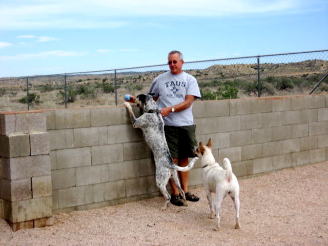
We spent the night at the USA Travel Park.  It was good to unwind.  The park had an enclosed dog run that the pups enjoyed.  Bandido had not chased a tennis ball for a long time.  We were surprised when he jumped over the cinder-block wall on our first visit, and relieved that he came back to us when we tempted him with a tennis ball.


The next day's drive on a mostly two-lane highway (US 491) was beautiful.  We passed endless mesas emerging from the flat landscape.  The highlight of the trip were the rocky spires that seemed to grow right out the flat plains.


The shiprock formation was a little too far away to get a good photo.  But, here is a somewhat hazy attempt.


Just before crossing the state line into Colorado, Dianne took this picture.


We intended to park the motor home at the Morefield Campground in Mesa Verde National Park, but it does not open for a few days.  Our excellent alternative was the A and A Mesa Verde RV Park, just across from the national park entrance. 


 We have a great site here with a great view.  (AND, we have the whole upper portion to ourselves -- D.)


As a bonus, a couple of beautiful horses graze next to our campsite, just on the other side of a barbed-wire fence.


The doggies are enjoying the horses, as well.


Dianne here...the pet photo of the day is actually a video clip I took of Bandido and Tequila playing "Who's got the ball?" inside the motor home one day while Roger was at a seminar at the recent RV Dreams rally.  Our furniture leads a hard life; hence the sheet over the couch.  They play hard, but they sure have fun!